Echo Sounder
Single (210kHz) or dual (210 / 33kHz) channel input, using unique “fuzzy
logic” DSP to give accurate readings and reliable performance, even in
shallow water. Data may be logged and output either raw (as measured) or
corrected for tide and heave.
Range: 0.3 - 100m (210kHz), 1.8 - 100m (33kHz)
Accuracy: greater of ±0.01m or ±0.02%
Resolution: 0.01m (210kHz), 0.04m (33kHz)
Sample Rate: 6Hz
Position
MIDAS Surveyor logs and displays DGPS position data in WGS84 or Local
Grid. User has full control over spheroid and projection constants for Local
Grid setup.
Standard: Integral 12 channel GPS/SBAS receiver with combined
antenna:
± 4m (CEP), with no correction
± 2m (CEP), with SBAS correction
Option : Surveyor also accepts user’s own differential, GPS or
RTK data input.
Other Inputs
The Surveyor will accept data input from all the additional sensors listed
below. All data may be logged and output in real time on a single RS232
channel, and tide & heave data may be used to provide real time
corrections to depth data.
Tide: RS232 text data from tide gauge or RTK.
Heave: RS232 data from heave sensor (up to 60Hz).
Sound Speed: Continuous or spot readings from Valeport Sound
Velocity Sensors may also be logged.
Gyro/Auxiliary: RS232 input of vessel heading or any other text string
may be logged with the survey data.
Event Marker: Surveyor is supplied with remote event marker
Data Outputs
Real Time RS232 output on a single channel of any, some or all of the
active data inputs, in choice of industry standard formats.
Memory
16Mb internal FLASH memory provides nominal 32 hours of data logging.
An optional 32Mbyte memory is available at time of order.
Data Display
240 x 128 pixel graphics LCD display, providing numerical and graphical
depth display, position data (WGS84 or Local Grid) and all other incoming
parameters. On screen help and simple menu-driven setup functions allow
full system control.
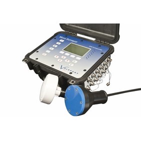
MIDAS Surveyor
Datasheet Reference: MIDAS Surveyor version 2A, Feb 2011
Internal: 8.4Ah sealed lead acid battery pack
External: 12 – 24vDC
Power: 3W (sampling), 25W (max when recharging)
Battery Life: Nominal 24hours working time
(Recharge using external power)
Connector: Fischer
Software
Surveyor is supplied with SurveyLog windows based software, allowing
data extraction & display. All data is presented in ASCII format, and
may easily be exported for use in industry standard hydrographic
survey software packages, or simple XYZ format data.
Physical
Surveyor: Rugged IP67 case, 35 x 33 x 16cm, 9kg
Accessories: IP67 case, 41 x 33 x 18cm, 9kg
Dual Tdx: Combined 210/33kHz, 30 x 30 x 10cm, 12kg
Shipping: 62 x 44 x 38cm, 18kg (basic set)
Basic
0420001 MIDAS Surveyor logging unit with 16Mb memory, internal
battery pack, DC power lead, RS232 output lead, event
marker, operating manual & SurveyLog software
0420002 210kHz transducer with 10m cable and mounting spigot
0420005 Integral 12 channel GPS/SBAS receiver with antenna, 5m
cable and mounting spigot.
Options
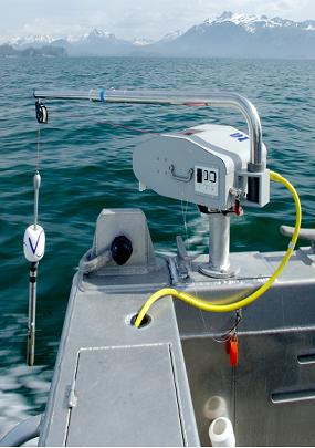
0420003 33kHz transducer with 10m cable and mounting spar
0420004 33/210kHz transducer with 10m cable and mounting spar
0420008 RS232 input lead for external data input (tide, heave etc.)
0420009 Memory upgrade to 32Mbyte


